
All models Flagship model · airborne LiDAR
Aerial mapping — Full-scene classification
A single airborne-LiDAR capture, fully classified in one automated run — proven at national scale.
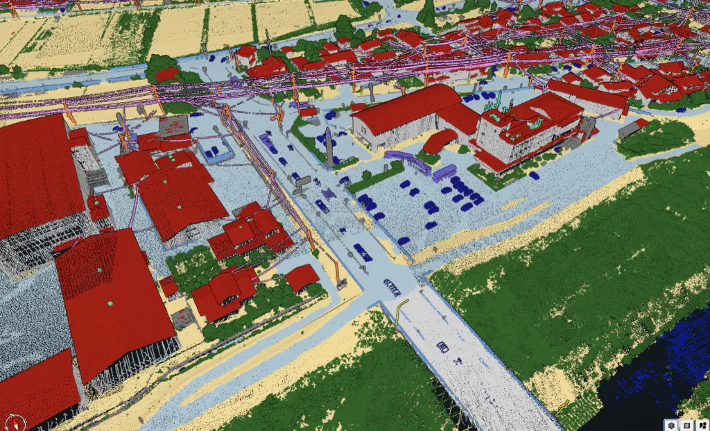
What it does
The workhorse for national mapping and aerial survey. From a single airborne-LiDAR capture, the model classifies the full scene — ground and water through buildings, vegetation, infrastructure and the power-line network — in one automated run, at 50–99% time savings versus manual editing.
Available categories
What it classifies.
Every point is assigned a typed class — then vectorised into objects your workflow consumes.
01Other (man-made)
02Ground
03Vegetation
06Buildings (roof)
07Low noise
09Water
17Bridge decks
18High noise
20Roof objects
21Vehicles
22Walls / facades
23Points below ground
24Low-voltage wires
25High-voltage wires
26Railroad wires
27Low-voltage towers
28High-voltage towers
29Railroad towers
30Fences
35Impervious surfaces
37Large vehicle
38Containers
39Street lamps
66Roof solar panels
67Solar panels
68Wind turbines
70Antennas