top of page

Blog
Explore Flai's recent innovations in automated LiDAR point cloud classification and processing through real-world use cases.
Learn how to navigate our website effectively with detailed guides for an optimized user experience
See Flai in action!


How to Keep Original (Ground) Labels Unchanged When Using Flai Classification
When you already have valuable labels in your point cloud data, you should not have to lose them when you run a new classification. This guide shows how to create a processing flow that keeps one or more input classes while applying Flai classification to everything else. A common pattern is to keep Ground from the input data while applying Flai’s classification to above-ground points. How Keeping Original Classification Works Under the hood, Flai’s AI models classify al
Nov 10, 20254 min read


Pushing the Boundaries of Situational Awareness at REPMUS 2025: Our AI-Driven REA Journey
This September, we were proud to participate in REPMUS 2025 — Robotic Experimentation & Prototyping using Maritime Unmanned Systems — as part of the Rapid Environmental Assessment (REA) Working Group . Together with our partners at FullWave GeoConsulting, we provided software solutions that leveraged AI to accelerate the production of situational awareness and environmental maps for both field operatives and decision-makers at the command level. REPMUS, hosted by the Portugue
Sep 29, 20252 min read


Flai in QGIS: open data and AI analysis one click away
QGIS is a leading open-source desktop GIS for Windows, macOS and Linux , used daily for cartography, spatial analysis, and 2D/3D data...
Sep 10, 20254 min read


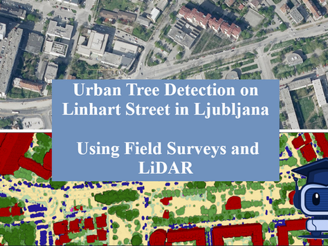
Urban Tree Detection in Ljubljana - Using Field Surveys and LiDAR
Urban trees are vital to the health and sustainability of city environments. They provide a range of ecosystem services, such as cooling...
Aug 5, 20253 min read


Automated Power Line Classification and Vectorization in Flai web app
In the rapidly evolving energy infrastructure landscape, power line management presents unique challenges for utilities and grid...
Jul 15, 20256 min read


Five LiDAR Software Tools: From Flight Planning to Classification
LiDAR (Light Detection and Ranging) has become a cornerstone in geospatial data collection—used for everything from forestry and...
Apr 24, 20252 min read


Introduction to LiDAR Point Cloud
LiDAR (Light Detection and Ranging) technology has become a cornerstone in fields like autonomous driving, robotics, environmental...
Apr 14, 20254 min read


Point cloud classification with machine learning: A short guide
Have you ever wondered how self-driving cars "see" the world? Or how robots understand 3D spaces? One key technology behind this magic is...
Apr 7, 20253 min read


How to thin the ground layer using Flai web app
In LiDAR (Light Detection and Ranging), the laser beam interacts with surfaces in three main ways: absorption, transmission, and...
Mar 28, 20256 min read


Basics of point cloud processing with AI
Point clouds are essential in 3D modeling, robotics, autonomous driving, and many other fields. They represent spatial data as a...
Mar 17, 20253 min read


How to improve point cloud project management
Managing point cloud projects effectively requires a combination of organization, the right tools, and a clear workflow. Since point...
Mar 7, 20254 min read


Applications of LiDAR in agriculture
Agriculture, one of humanity's oldest endeavours, uses state-of-the-art technologies to meet the challenges of a growing world...
Feb 25, 20254 min read


Top free LiDAR data sources
LiDAR technology has rapidly become a tool in mapping, forestry, urban planning, disaster management, and many other fields. What was...
Feb 13, 20253 min read


Challenges and opportunities in point cloud data processing
Point cloud data, a collection of spatial data points representing the surface of objects or environments, has become a cornerstone in...
Feb 3, 20253 min read


5 best LiDAR processing software
LiDAR technology has revolutionized the way we gather and analyze spatial data, offering unparalleled precision and versatility across...
Jan 23, 20256 min read


Five best cloud-based GIS tools
As access to data collection becomes easier, the sheer volume of geospatial data being collected is skyrocketing, creating new challenges...
Jan 13, 20255 min read


LiDAR Tech Trends in 2024
LiDAR technology has rapidly evolved from niche applications to mainstream adoption across multiple industries. LiDAR is no longer just...
Jan 6, 20254 min read


Automating LiDAR data workflows
LiDAR technology has transformed the way we map terrain and collect spatial data, becoming more accessible as hardware advances and costs...
Dec 20, 20244 min read


How to become a GIS consultant
In today’s data-rich world, Geographic Information System (GIS) consultants are key players in helping organizations make informed,...
Dec 2, 20244 min read


Power Grid Vegetation Analysis with LiDAR and AI
Challenge of Vegetation Management Near Power Lines ELES faced a significant challenge in monitoring and predicting vegetation growth...
Oct 14, 20243 min read


Top Advanced Tools Every Geospatial Consultant Needs
In today's rapidly evolving field of geospatial consulting, the importance of leveraging advanced tools cannot be overstated. Whether...
Aug 24, 20247 min read


How to grow a geospatial consultancy
We are capturing more data than ever before. Data is captured from various sources, including satellites, planes, drones, cars, boats,...
Aug 7, 20244 min read


Batch Processing on Flai web app
Alongside the classical use of the Flai web application, Flai enables faster processing of point cloud data through Batch Processing. The...
May 24, 20242 min read


Elevating Precision: Introducing Point Cloud Quality Control Service
In the ever-evolving landscape of 3D mapping and analysis, the integrity and accuracy of point cloud data are paramount. Recognizing the...
Mar 28, 20242 min read


Running Flai flows on your local machines
Among other deployment options, Flai supports running the automatic classification flows on your hardware, keeping all data private to...
Mar 19, 20243 min read


Classify point clouds through APIs
In this blog post, we will delve into how API integrations are transforming interactions with AI technologies in point cloud processing....
Feb 27, 20244 min read


Forest damage assessment from LiDAR point cloud using Artificial Intelligence
On Monday, July 24, wind gusts exceeding 200 km/h swept through the city of La Chaux-de-Fonds in northwestern Switzerland. The winds left...
Nov 24, 20233 min read


Automatically classify mobile mapping LiDAR datasets with ease
The need for regularly updated and accurate geospatial data has grown exponentially in the last decades. Mobile mapping LiDAR data serve...
Sep 25, 20232 min read


Online sharing of point clouds using Flai Web Application
In today's data-driven world, seamless collaboration and sharing of datasets are vital for efficient analysis and decision-making. Flai,...
Jul 2, 20232 min read


Interpret your data by combining multiple sources
Looking at objects in geospatial data taken from one angle or by only one particular sensor can be challenging, especially when handling...
Jun 16, 20233 min read


Enhance Your Workflow with Flai's Processing Flow Templates
Flai's web application offers over 36 raster and point cloud flow processing nodes, providing a comprehensive set of tools for your data...
May 26, 20232 min read


Using AI to improve forest inventory
Forestry inventory is a crucial aspect of sustainable forest management. It involves collecting data on the characteristics of a forest,...
Apr 12, 20233 min read


Leverage AI for automated point cloud processing
Software as a Service for streamlining point cloud processing workflows The creation of an accurately classified point cloud usually...
Mar 15, 20236 min read


Creating rasters from point clouds with Flai web app
Creating fully annotated point clouds is usually only the first step to producing a product that can be used and understood by a wider...
Jan 16, 20235 min read


Using LiDAR point clouds in precision forestry applications
LiDAR proved to be a suitable technology for forestry applications as it can penetrate the canopy and accurately detect tree structure...
Jan 12, 20233 min read


Scheduled maintenance - 29.12.2022
We wanted to let you know that Flai web application will be down for scheduled maintenance, starting on 29.12.2022 at 03:00 (CET) and...
Dec 28, 20221 min read


Introducing Flai Web App: Automatic point cloud classification platform powered by AI
We are excited to announce the launch of our Flai Web App , a platform that automates point cloud classification using advanced AI...
Oct 27, 20224 min read


Automatic extraction of ground points of a rockface using Artificial Intelligence
In this project, the goal was to get ground points of a densely vegetated rockface to analyze the rock structure. This task could only be...
Sep 23, 20223 min read


How to use annotation tools in Flai web application
Point cloud datasets produced by 3D laser scanning or photogrammetry gain a lot of value if they are accurately classified. While AI...
May 18, 20222 min read
bottom of page
