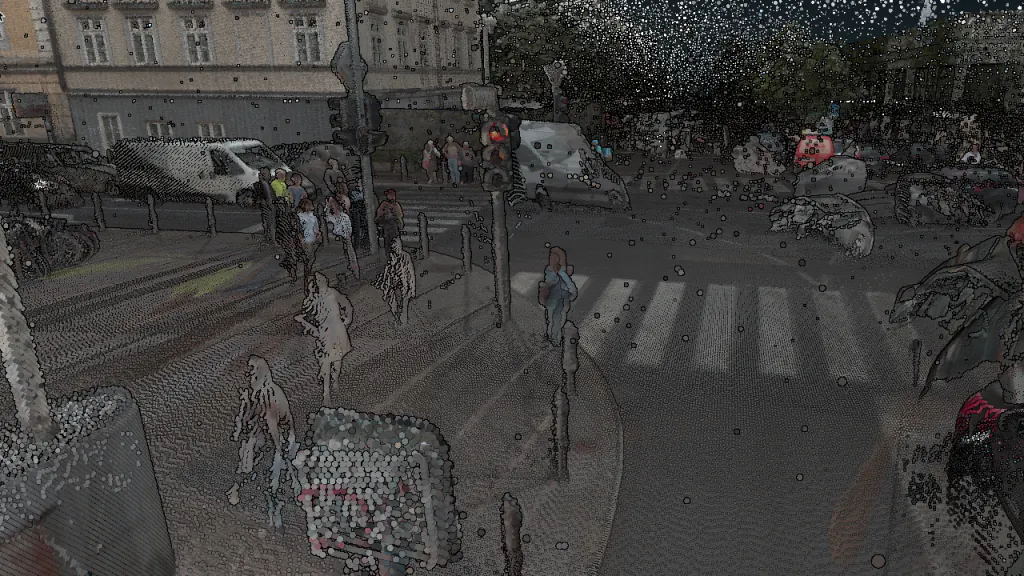
From street-level LiDAR to extraction-ready data in minutes, not days

Flai automates classification of dense, close-range mobile laser scanning: transient objects and noise removed, the road corridor separated into asset-grade classes, and a clean, classified cloud delivered straight to your extraction, GIS and digital-twin workflows.
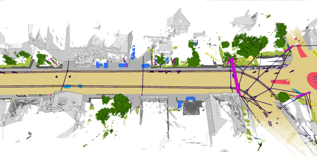
Mobile mapping classification banner
27
classes out of the box, from road markings to signs, lamps and tree trunks
1 run
from cleanup to detailed classification in a single automated pass
Minutes
typical turnaround from raw MLS upload to a classified, extraction-ready cloud
200+
customers across 50+ countries: mapping companies, utilities and agencies

Specialized classification for mobile mapping

Flai's mobile mapping AI model is built for dense, cluttered street- and city-scale point clouds, from vehicle-, rail- and backpack-mounted LiDAR to handheld SLAM scanners. It separates the road corridor into 27 asset-grade classes in a single automated pass, then hands a clean, transient-free cloud to your extraction and analysis tools.

Raw MLS goes in, and semantically classified, extraction-ready data comes out, with the same model and schema on every drive.
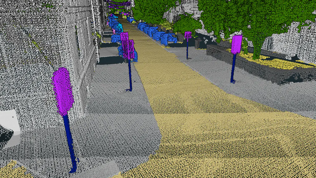
Classified mobile mapping scene

What Flai does for mobile mapping teams

Automated classification

Pretrained AI model for dense, close-range MLS clouds, every class straight from raw LAS/LAZ.

Transient object removal

Pedestrians, moving vehicles and noise stripped out, a clean base cloud for extraction.

Asset-inventory granularity

Individual traffic signs, street lamps, masts and wires, the detail digital-twin programs need.

Road surface detail

Road, sidewalk, curbs, markings, crossings, islands and guard rails separated for surface and safety analysis.

Works with any sensor

Vehicle-, rail- or backpack-mounted LiDAR and handheld SLAM scanners, any dense, close-range cloud.

Adaptable to your assets

Add custom classes for your own assets and fine-tune the AI on your own data.

Open, standard formats

LAS / LAZ / COPC / E57 in, classified LAS/LAZ and GIS-ready vectors out.

Scales with your fleet

Tiled processing of 100GB+ projects, batch throughput for city- and network-scale campaigns.
The mobile mapping workflow, end to end

01 · Ingest
Import LiDAR
LAS, LAZ, COPC, E57, PLY, dense clouds from vehicle, rail, backpack or handheld scanners.
02 · Prep
Pre-process
Noise and outlier filtering, cluster cleanup, tiling for large projects.
03 · Classify
AI classification
Pretrained mobile mapping model classifies the full road corridor.
04 · Vectorize
Point & line objects
Classification as the base for vector extraction of signs, lamps and curbs.
05 · Export
Deliver & export
Classified LAS/LAZ, GIS-ready layers, CSV / SHP / API.

27 classes recognized out of the box

RoadSidewalkOther groundTraffic islandCurbsRoad markingsBuildingsTunnelFencesOtherNoiseGuard railConcrete barrierCrash cushionTraffic lightsTraffic signsOther traffic markersStreet lampsMastsWiresTreesTree trunksOther vegetationPedestriansTwo-wheelMobile four-wheelStationary four-wheel

What teams build on it

  • Road asset inventoriesSigns, lamps, masts and barriers as separated classes, ready for extraction into GIS registers.
  • Digital-twin base dataA clean, classified cloud that drops straight into digital-twin, CAD and GIS platforms.
  • Surface & safety analysisRoad, markings, curbs and islands separated for pavement, marking-wear and clearance work.
  • Consistent quality at scaleThe same model and schema on every drive, validated in production with MLS providers.
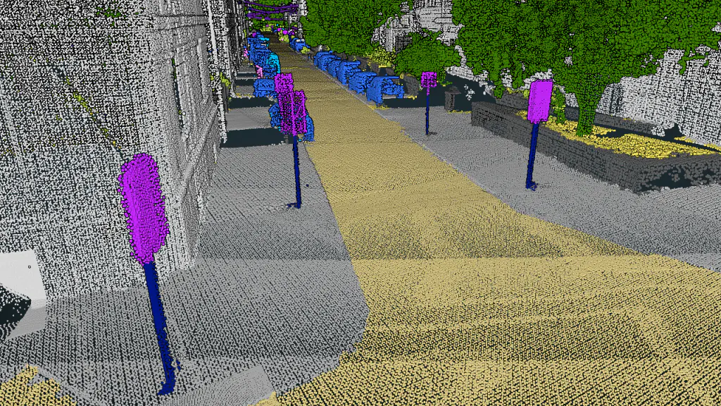
Street-level detection of road signs and signals
Street-level detection of signs, lamps and markings, down to individual assets.

"For years, classification was the bottleneck that chewed through time, budget and analyst bandwidth before the real work could begin. With Flai, raw LiDAR goes straight in and semantically classified, extraction-ready data comes out in minutes, not days."

Kyle Metiva · CTO, New Compass Solutions

Ways to run Flai

Flai WebApp

Visual processing flows, 3D viewer, classification editor and QA tools. On Flai cloud or self-hosted in your own environment.

Flai CLI

Windows and Linux binaries for your own processing pipeline, from workstation to fully on-premise and air-gapped networks.

Flai API & SDK

Embed Flai classification directly in your own platform or product via REST API and Python SDK.

Try it on your own drive data, free

Process a sample dataset and see classified, extraction-ready results in minutes.