3D spatial intelligence for NATO and Allied forces
From raw sensor data to decision-ready 3D intelligence, across land, complex urban, air, and sea. One AI engine turns any point cloud into a segmented, queryable picture of the terrain and the objects within it.
Supported by


Where can heavy armour move? What threats lie on the seabed? Where can a helicopter land?
Commanders need answers in three dimensions, faster than the adversary moves. Flai turns raw 3D sensor data into those answers.
One engine, every domain
Enhancing how the Alliance plans and fights today, in hours rather than days.
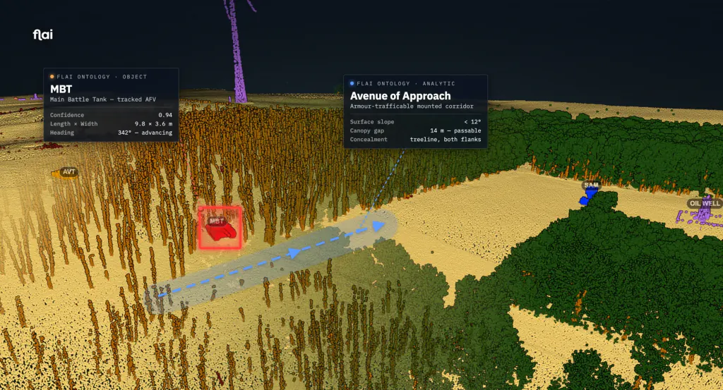
Where forces can move
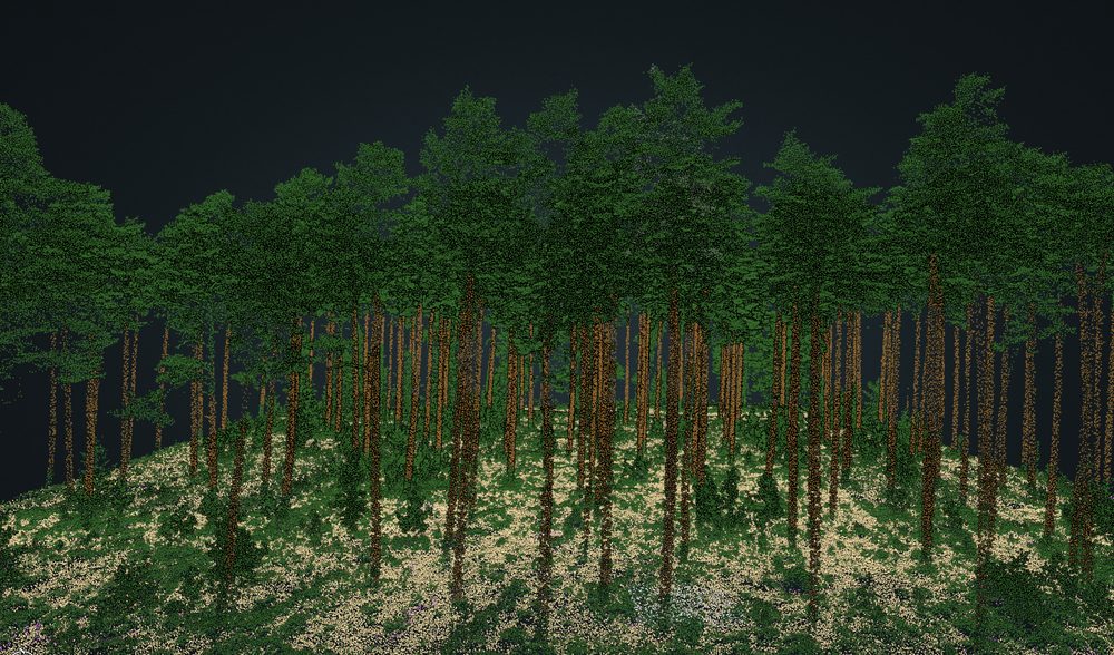
- Forest trafficability from single tree-trunk detail: where armour and dismounts can actually move.
- Slope, cover, and concealment read straight from full 3D terrain, not a flat map.
- Military objects surfaced in 3D: anti-air, trenches, fortifications.
Feeds OAKOC terrain analysis and the JIPOE obstacle overlay.
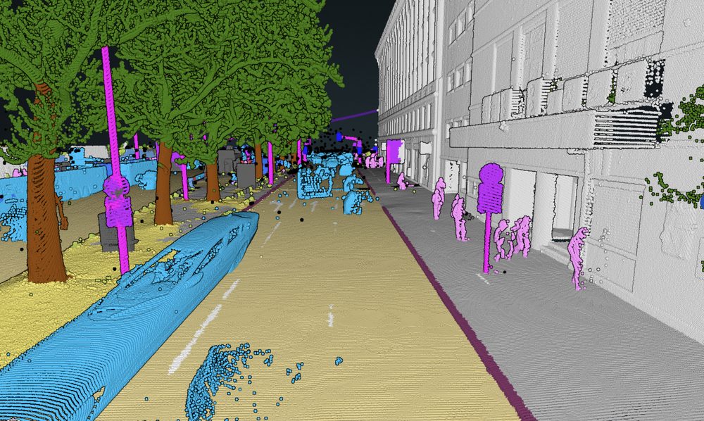
Every corner, before the team commits
- Building entry points and wall heights for breach planning.
- Every line-of-sight dead-space pocket mapped: the blind corner before the team commits.
- Permanent structure versus temporary clutter, classified automatically.
Structured observations feed faster course-of-action development and a tighter OODA loop.
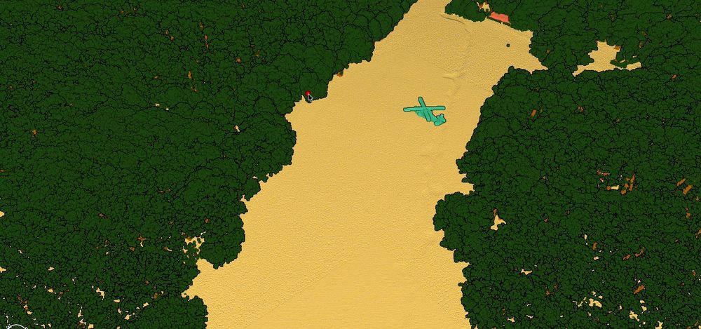
Where aircraft can operate
- Helicopter landing zones with high-obstacle clearance.
- Vertical obstructions mapped: wires, masts, towers, and antennas that threaten low-level flight.
- Drop zones and nap-of-the-earth approach corridors from true 3D terrain.
Supports air mission planning and flight-safety obstacle clearance.
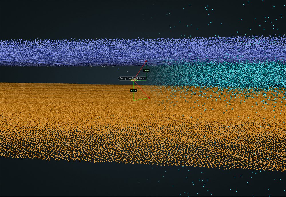
Threats on the seabed
- Green bathymetric LiDAR penetrates up to 40 m of water.
- Onboard detection of submerged naval mines, streamed live to the ship’s commander.
- Around 200k points per second on consumer-grade hardware: real time at sensor rates.
Contacts stream into the common operational picture and the ship’s command and control.
Three capabilities, one pass
Helicopter landing-zone identification with high-obstacle clearance, anti-air detection, and forest traversability from single tree-trunk detail.
One source of 3D truth, every echelon
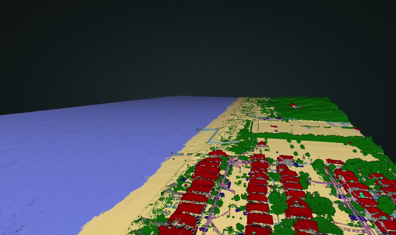
The same engine serves the tactical commander, the operational planner, and the strategic picture. Ingest a dataset, run the AI model, and get back typed ontology objects with provenance.
Those objects drop straight into your command-and-control, GIS, and AI tools, delivered as files or served over an API. No bespoke connector, no manual re-labelling.
Built for your network
Managed cloud, sovereign on-premise, or fully air-gapped. Proven inside an Allied MoD network.
OGC formats in and out. STANAG 4545, 7074, and 2592 layers for NATO mission systems.
REST API, a Python SDK, and a standalone CLI. Connectors for S3, SFTP, FTP, WMS, WMTS, and XYZ.
An MCP server lets any AI agent drive Flai tools directly, with no bespoke connector.
Already proven in defence
- Allied Ministry of DefenceAir-gapped platform running inside an Allied MoD network, validated by live drone-LiDAR on a military range.
- NATO REPMUS 2024 and 2025Supported the Rapid Environment Assessment team: port mapping, bathymetry, and green-LiDAR naval-mine detection.
- ESA and EUDISEuropean Space Agency contracts, and selected for the EU Defence Innovation Scheme (EUDIS) Business Accelerator.
What sets the engine apart
- A European 3D data moatA pre-existing European baseline no other vendor ships: over 300 TB of open LiDAR across 16 countries, corpus and ground-truth in one.
- True 3D, not flat imageryWe reason in 3D geometry, surfacing trenches, berms, and camouflage that 2D imagery misses.
- Sovereign and rapidAir-gapped deployment, and rapid retraining on synthetic data to adapt to a new threat or theatre in days, inside your own network.
Let's turn your sensor data into decisions
Get in touch to discuss deployment options for defence and security programs.