
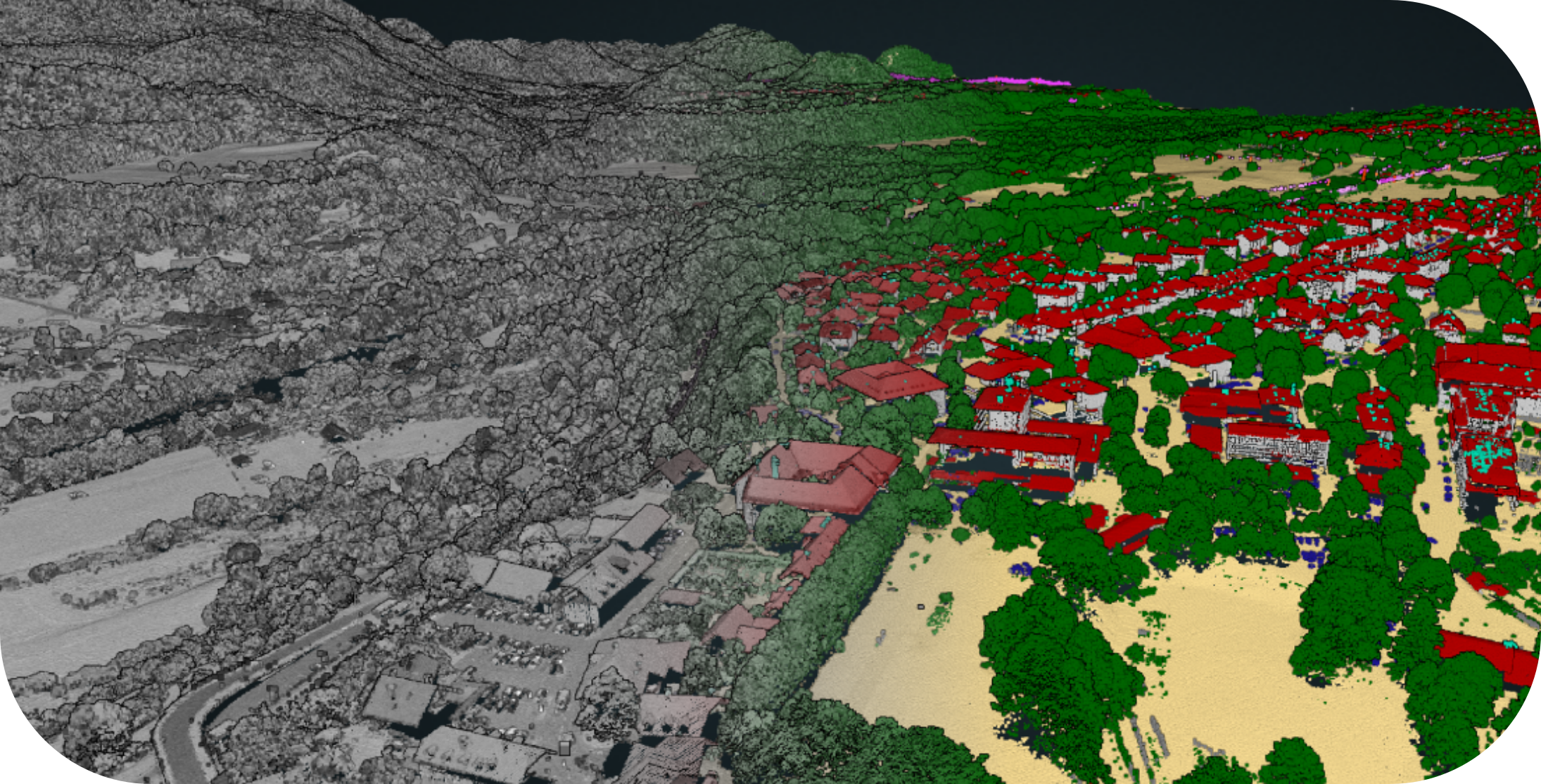
LiDAR technology has rapidly become a tool in mapping, forestry, urban planning, disaster management, and many other fields. What was once an expensive and niche technology is now widely adopted, with governments, research institutions, and private organizations across the world making their LiDAR datasets freely available. Many countries have recognized the immense value of nationwide LiDAR surveys for infrastructure planning, environmental monitoring, and disaster prevention. Governments in across the world are systematically scanning their landscapes and making this data publicly accessible. Additionally, global platforms and community-driven initiatives have emerged to make LiDAR data even easier to find and use.
With so many free LiDAR sources available, it’s now easier to access high-quality elevation and terrain data for various applications. Below, we explore some of the best sources for free LiDAR data and how you can use them for your projects.
🚀 How to Choose the Right LiDAR Data Source?
When selecting a LiDAR dataset, consider:
🔹 Region: Where is your area of interest?
🔹 Resolution: Do you need high-density point clouds or general elevation data?
🔹 File Format: LAS, LAZ, or derived DEM products?
🔹 Application: Mapping, forestry, urban planning, or scientific research?
🌍 Top Free LiDAR Data Sources
USGS 3DEP LiDAR Data (United States)
📍Website:USGS National Map
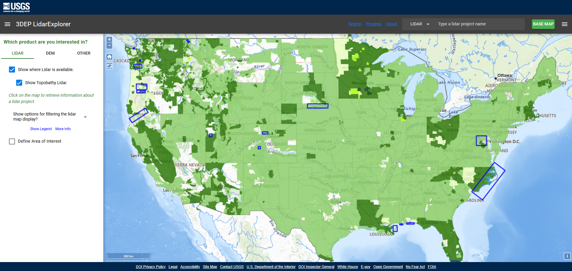
The 3D Elevation Program (3DEP) by the U.S. Geological Survey (USGS) provides extensive LiDAR coverage across the United States. You can access raw point clouds, DEMs, and other elevation datasets for free, making it one of the most valuable sources of elevation data.
Why Use It?
✔ High-resolution LiDAR data for various states
✔ Easy access via the National Map LiDAR Explorer
✔ Available in LAS and LAZ formats
✔ Easy bulk-download options for large-scale projects
Flai LiDAR Hub
🎈 Website: Flai LiDAR Hub
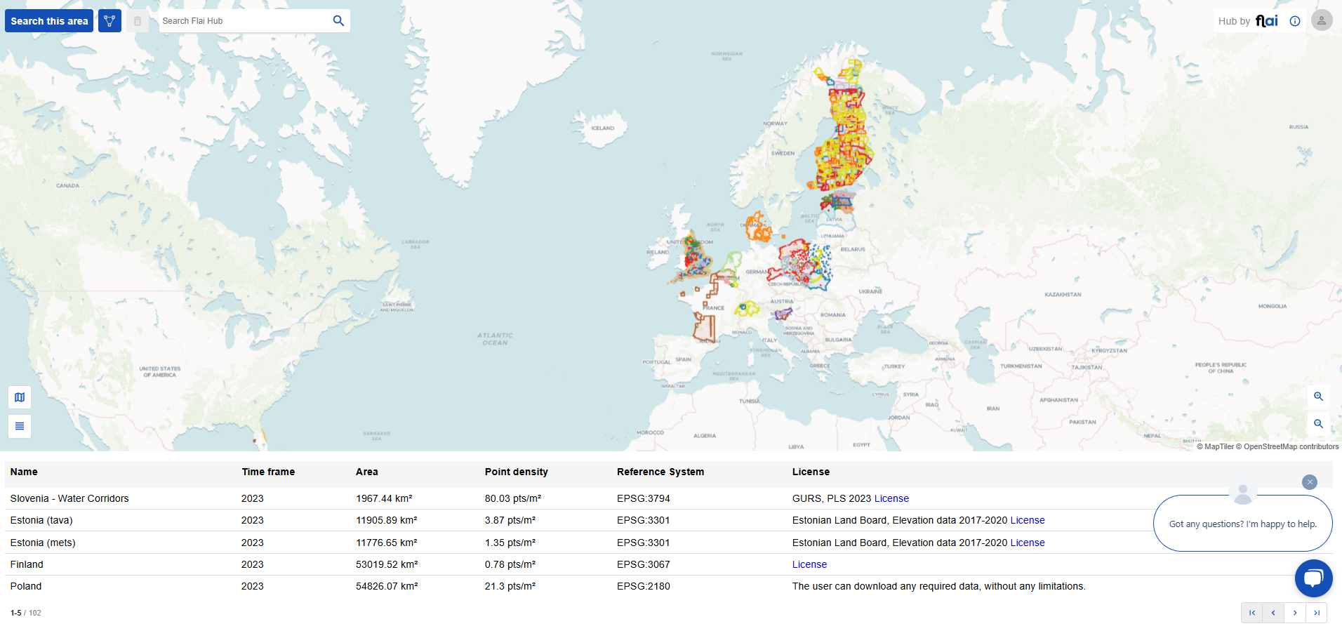
Flai LiDAR Hub is a user-friendly online platform for discovering and downloading LiDAR datasets. It aggregates publicly available LiDAR data and provides advanced tools for easy visualization, filtering, and downloading, making it a great resource for professionals and hobbyists alike.
Why Use It?
✔ Intuitive interface with built-in LiDAR visualization tools
✔ Consolidates data from multiple open sources
✔ Great for researchers and GIS professionals
✔ Easily view the point cloud directly on the website without needing additional software
✔ Flexible area selection—not tied to a single predefined sheet, allowing for custom downloads
OpenTopography
📌 Website: OpenTopography
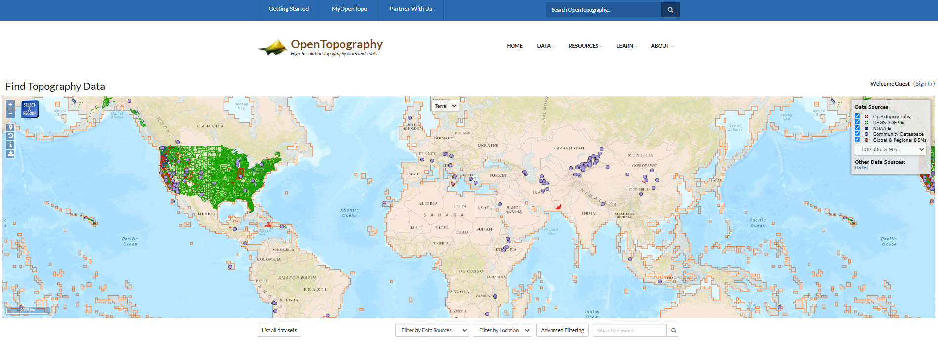
OpenTopography is a go-to resource for global LiDAR data. It offers high-resolution topographic data from research projects and government agencies, primarily in the U.S. but also from other regions.
Why Use It?
✔ LiDAR and DEM datasets from academic research
✔ Free access to point clouds and derived products
✔ Advanced filtering and processing tools
NOAA Data Access Viewer
💫 Website: NOAA Data Access Viewer
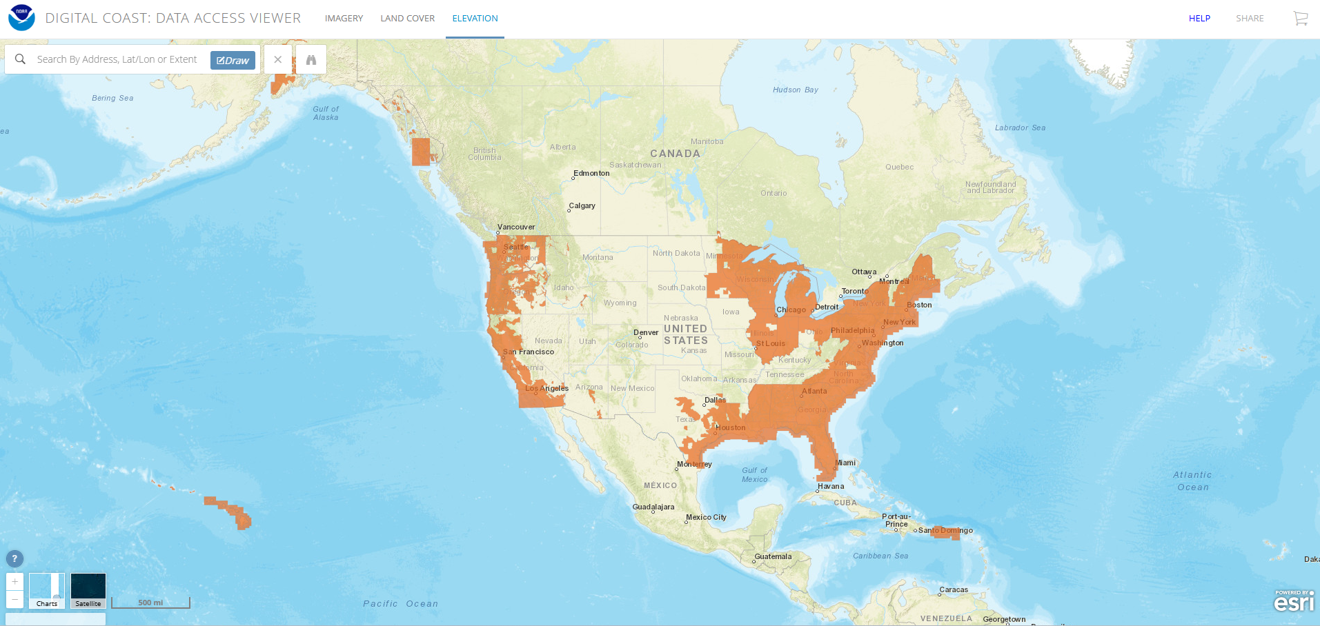
The National Oceanic and Atmospheric Administration (NOAA) offers free coastal LiDAR datasets. If you’re working on projects related to flood modeling, coastal erosion, or marine environments, this is a fantastic resource.
Why Use It?
✔ High-resolution LiDAR for coastal areas
✔ Valuable for climate change and coastal studies
✔ Available in multiple formats
🗺️Countries Providing Free LiDAR Data
In recent years, numerous European countries have recognized the significant benefits of LiDAR technology for applications such as environmental monitoring, urban planning, and disaster management. Consequently, many have initiated nationwide LiDAR scanning projects and made the resulting datasets publicly accessible through dedicated platforms. Below is an overview of some of these initiatives:
🚀 The Future of Free LiDAR Data
Despite the growing availability of free LiDAR data, one of the biggest challenges remains finding and accessing the right datasets. Each country hosts its LiDAR data on different government or institutional websites, requiring users to search across multiple platforms, navigate varying formats, and sometimes deal with language barriers. This fragmentation makes it time-consuming and complex to gather data for cross-border studies or large-scale projects.
The trend is now shifting towards consolidated LiDAR hubs, where data from multiple countries is collected in one place. Platforms like Flai LiDAR Hub are helping to bridge this gap by providing an aggregated environment where users can easily search, visualize, and download LiDAR datasets from different sources. These centralized platforms significantly simplify the process, making querying and accessing data much more efficient.
As more countries adopt open-access LiDAR policies, the future of LiDAR data lies in platforms that bring this information together, offering a single, user-friendly interface for researchers, GIS professionals, and developers worldwide.