
All models Mobile mapping · vehicle LiDAR
Mobile mapping — Street-level detail
Dense, close-range mobile LiDAR classified to asset-inventory granularity.
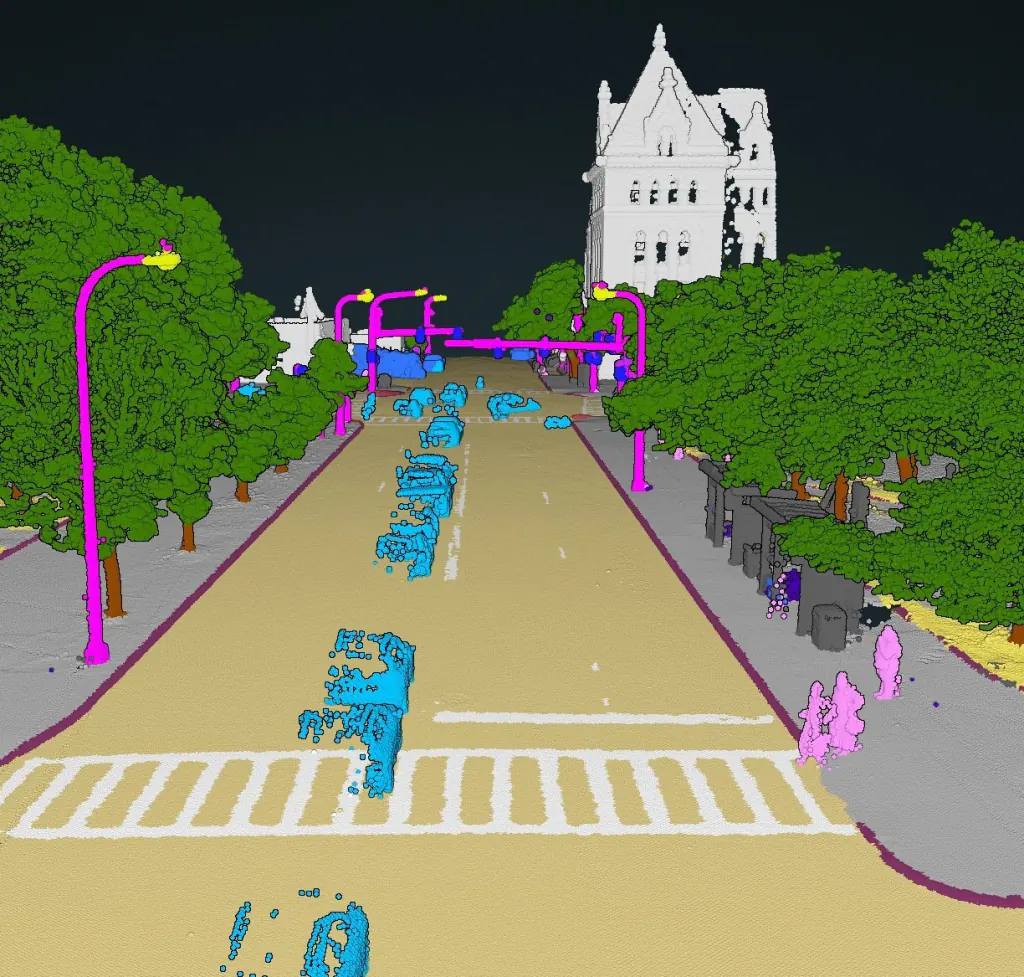
What it does
Built for vehicle-mounted mobile laser scanning and the dense, close-range clouds it produces. The model separates the road surface and its furniture down to individual tree trunks, road signs and moving versus parked vehicles — the asset detail road authorities and digital-twin programmes need.
Available categories
What it classifies.
Every point is assigned a typed class — then vectorised into objects your workflow consumes.
01Other
02Road
03Sidewalk
04Other ground
05Traffic island
06Buildings
07Trees
08Other vegetation
09Traffic lights
10Traffic signs
11Wires
12Masts
13Pedestrians
15Two-wheel
16Mobile four-wheel
17Stationary four-wheel
18Noise
40Tree trunks