
All models Bathymetry · maritime · through-water
Bathymetry — Seabed & maritime infrastructure
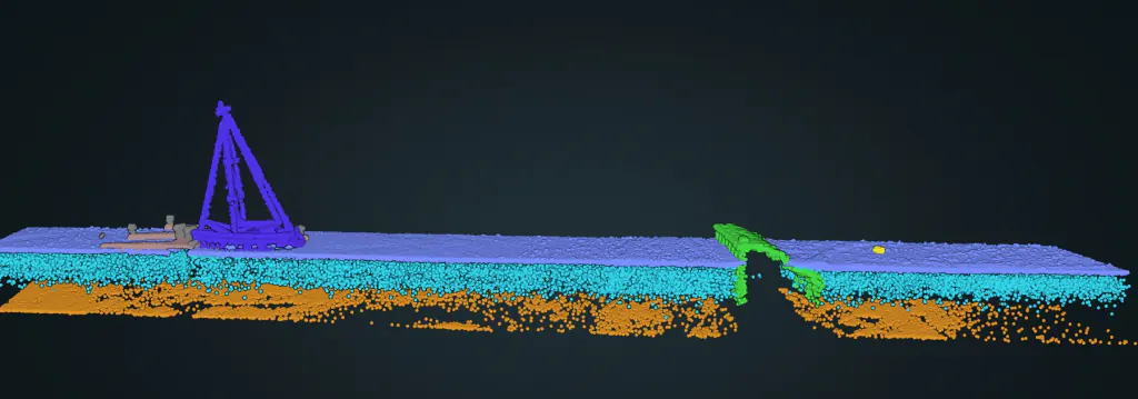
Water surface, column and seabed — plus vessels, piers, cranes, buoys and breakwaters, all typed.
What it does
Green bathymetric LiDAR penetrates up to roughly forty metres of water, and FlaiCortex classifies the returns through the water column — separating surface, column and seabed. Beyond the seabed it types the whole maritime scene — vessels, piers, cranes, buoys, breakwaters and underwater structures — and cues naval mines and obstacles. Throughput on consumer-grade hardware is enough to run onboard, in real time.
Available categories
What it classifies.
Every point is assigned a typed class — then vectorised into objects your workflow consumes.
01Other
02Ground
03Vegetation
06Building
07Low noise (water column)
09Water
18High noise
21Vehicles
38Containers
52Bathy ground (seabed)
53Naval mines
54Pier
55Vessel
56Buoy
57Crane
58Breakwater
59Underwater structures