Flai and LumiDB are partnering to connect classification and data delivery. The idea is simple: the moment a Flai model finishes labeling a dataset, that dataset should already be queryable, streamable and shareable, instead of becoming another set of files somebody has to move.
LumiDB published their side of this on 17 June 2026.
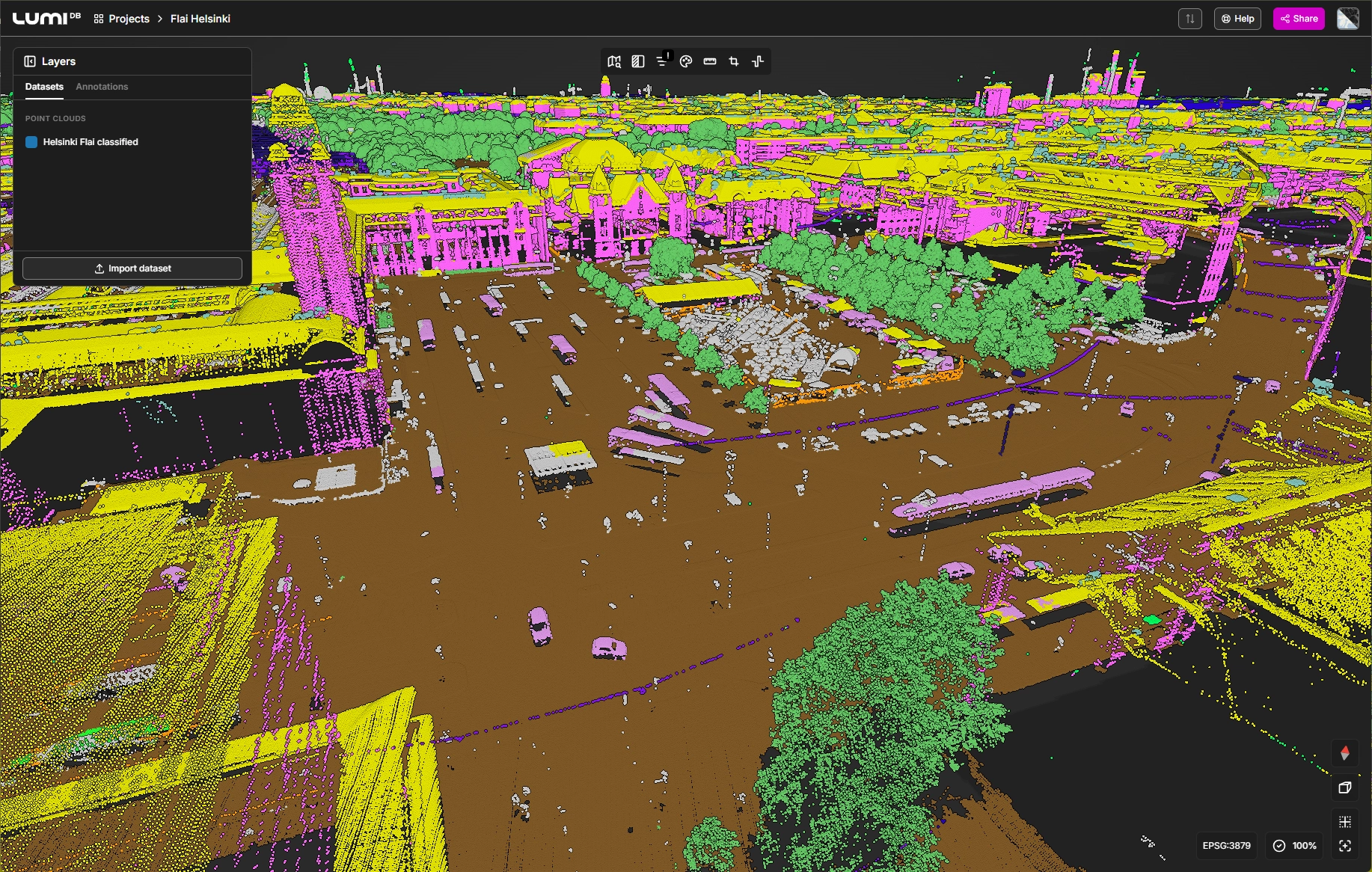
LiDAR dataset of the City of Helsinki, 2022, classified with a Flai model and served in the LumiDB viewer. Dataset courtesy of Helsingin kaupunkiympäristön toimiala.
Why LumiDB
We see the same pattern often enough to name it: a team automates classification, cuts days of manual work out of the process, and then loses the gain again downstream. The classified data goes back into tiles on a network drive, gets copied per department, gets opened in desktop software that takes minutes per file, and gets sent to the client on a hard drive.
LumiDB attacks precisely that part of the problem, and it is built for the scale our datasets actually come in at:
- A database, not a folder. It is purpose-built and 3D-first, indexing point clouds, rasters, vectors and project deliverables together, and treating a whole collection of files as one dataset. Tile boundaries stop being something the user has to think about. LumiDB reports sub-second spatial queries at petabyte scale, and has ingested New Zealand's entire North Island, which they put at 1.7 trillion points.
- Browser-native. Progressive streaming means a colleague who does not own or want a point cloud workstation can open a national dataset in a browser tab and query it by drawing a polygon. That matters because the people who need answers from classified data are usually not the people who process it.
- It plugs into the tools people already use. Live streaming into ArcGIS Pro over I3S, QGIS, Cesium 3D Tiles and EPT, direct publishing from Terrasolid TerraScan, and export to LAZ, E57 or glTF on demand. Everything is reachable through the API, so this is an integration surface rather than another destination.
- It can stay inside your environment. Private and self-hosted deployment is supported, which is the same reason our own CLI and self-hosted options exist. Plenty of the data we classify is not allowed to sit in somebody else's cloud.
What the combination changes
Flai supplies the semantic layer. Our pretrained models cover aerial mapping, forestry, mobile mapping and indoor stockpiles, and they run at national scale: the Digital Twin Germany work alone covers tens of thousands of square kilometers. LumiDB supplies the layer that makes the result usable by an organization rather than by one specialist.
Connected, that means no duplicate copies of very large files for GIS, BIM and CAD consumers, no desktop install as a precondition for looking at the data, and sharing with an external stakeholder by sending a link. One classified source of truth, reachable by everyone who needs it.
Shaping the integration
This is early, and LumiDB is looking for hero users to help decide what gets built first. If your team would gain from a connected classify-then-query workflow, they are booking 30-minute workflow reviews, and a city-wide Flai-classified LiDAR dataset is available for demos on request. Early input shapes more of the design.
You can reach them through lumidb.com, or talk to us if you would rather start from the classification side.