Forest damage assessment from LiDAR point cloud using Artificial Intelligence
- Nov 24, 2023
- 3 min read
Updated: Mar 5, 2024
On Monday, July 24, wind gusts exceeding 200 km/h swept through the city of La Chaux-de-Fonds in northwestern Switzerland. The winds left devastating damage on buildings and in forests around the city. Estimating the exact extent of such damage can be challenging, especially in densely vegetated areas and on rugged terrain. Therefore, LiDAR scanning of the area was initiated to map the damage extent and count all uprooted and downed trees in the area.
Location
La Chaux-de-Fonds, Switzerland
Sensor
Riegl VQ 480 II at 2Mhz
Flight operator
Helimap
Number of points
4.8 billion points
Point density
150 pts/m2
Number of detected fallen trees
10.000 trees or their parts
Area
3223 ha
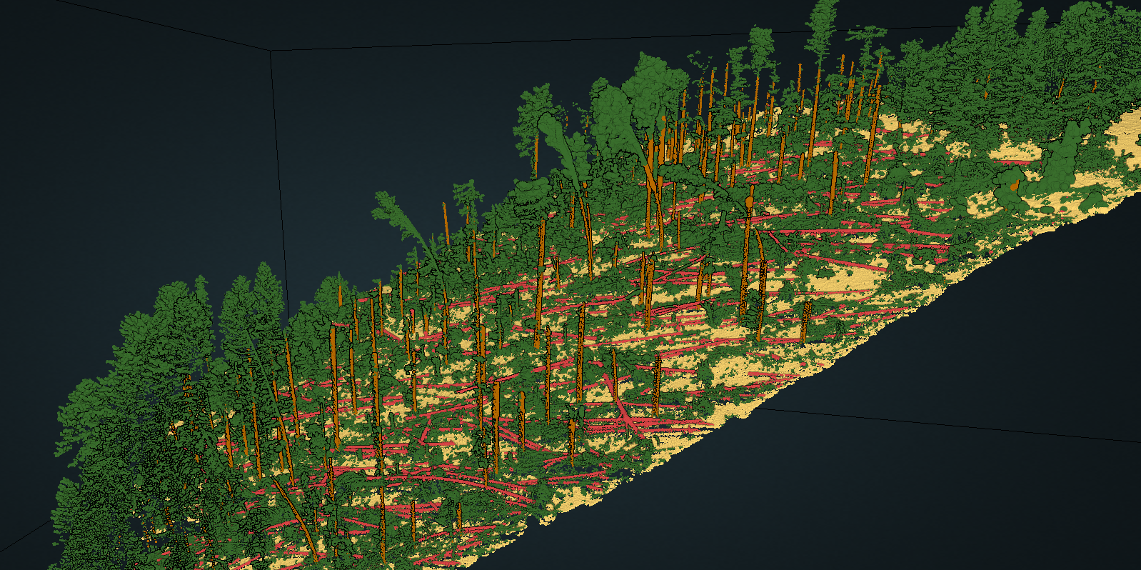
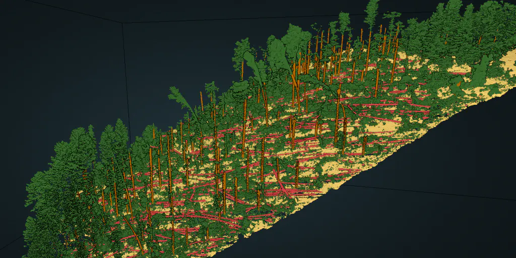
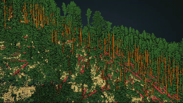
Extensive damage in forest area. Brown points identify detected trunks and red points fallen tree trunks.
Company presentation
In La Chaux-de-Fonds, the flight has been conducted 2 days after the events. The end products delivered three days after their acquisition made it possible to carry out the first quantified analyses of the damage caused by the disaster.
The data were acquired by Helimap System SA, an airborne LiDAR/Photogrammetric mapping service provider, based in Epalinges, Switzerland, specialising in very high resolution/density mapping and fast response intervention.
Data analysis and damage assessment were requested by Service de la Géomatique, which is a part of the Neuchatel canton, Switzerland. To provide the services to the community, they extensively use airborne, mobile and bathymetry LiDAR data.
Based on their efforts, the 2D geoportal (GÉOPORTAIL 2D DU SITN) and 3D Lidar geoportal (GÉOPORTAIL LiDAR DU SITN) are regularly updated with numerous layers derived from LiDAR data:
raw point clouds,
classified and colourized point clouds,
digital terrain models, digital surface models, canopy height models
LOD0, LOD1 and LOD2 building models.
Storm damage mapping using LiDAR and Artificial Intelligence
The Flai team was tasked with point cloud classification and initial vectorization of all fallen trees marked by the classification procedure.
To get the best possible classification results, we first ran both (Aerial Mapping and Forestry) our FlaiNet Artificial Intelligence point cloud semantic classification models to get a detailed damage view of both urban and forest areas.
For all further processing, we focused only on vegetated areas as our prediction model can directly classify points that belong to trunks of fallen trees. They can be detected directly lying on the ground, leaning at large angles or embedded between other vegetation such as understory or branches of other fallen trees.
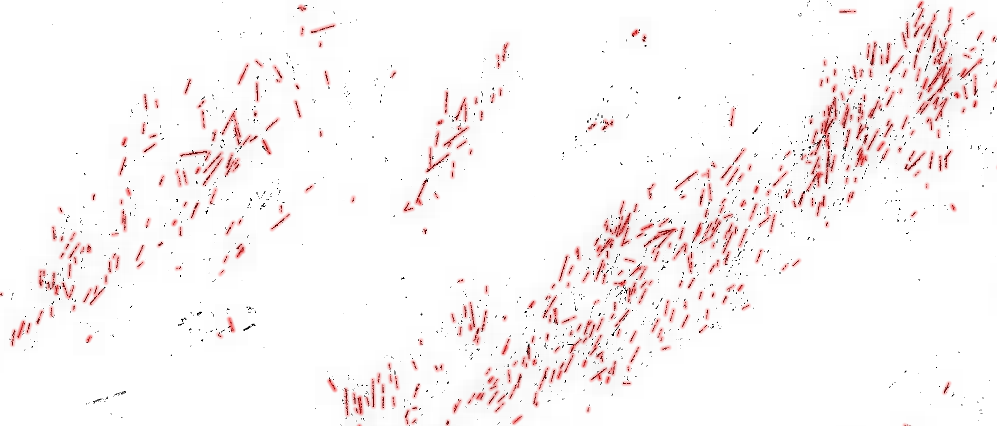
Linearization of fallen trees. Small clumps are intentionally left out of the process as they might represent miss classification or smaller parts of the tress.
The fallen trunk detection and vectorization are initially done in two-dimensional space. Therefore, the first step of the process involves a rasterization of the fallen tree mask and the density of the detected points. This approach was chosen as working with 2D images eases and speeds up steps such as filtering and neighbouring operations.
The filtered fallen tree raster mask was used in the vectorization process where trunks of different lengths can be detected. We were starting with the longest, removing them from the mask and continuing with shorter less reliable detections. The final product can be seen in the image above and as 3D vectors in the point cloud below. In the whole analysed area, we identified more than 10,000 fallen trees or their parts.
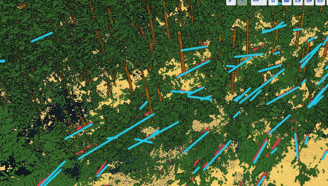
Identified and vectorised trunks are shown by cyan vectors.
Creating actionable data for forest damage management
The generated vector files show potential to be used by different services working on the forest storm damage analysis and repair:
Defining the Extent of Damage: The vector files can be used to define the extent of damage caused by the storm. This is crucial for understanding the scale of the impact and identifying areas that require urgent inspection for security management of the forest area.
Orientation of Fallen Tree Trunks: The vector data can help determine the orientation of fallen tree trunks. This information is valuable as it is often manually drawn, and the automated vector data can save time in this process.
Assisting Forestry Operations: The generated vector files can assist forestry operations in the removal of damaged areas by providing a clear representation of the extent of damage in specific locations. This information is vital for planning and executing effective repair and restoration efforts.
Identified and vectorised trunks are shown by cyan vectors.
Tags:
Recent Posts
How to Keep Original (Ground) Labels Unchanged When Using Flai Classification
Pushing the Boundaries of Situational Awareness at REPMUS 2025: Our AI-Driven REA Journey