- Jan 23, 2025
- 6 min read
Updated: Apr 15, 2025
LiDAR technology has revolutionized the way we gather and analyze spatial data, offering unparalleled precision and versatility across various industries. From creating detailed digital elevation models to automating point cloud classification, LiDAR processing software plays a critical role in unlocking the potential of this data. Whether you’re a geospatial professional, an environmental scientist, or a city planner, choosing the right tool can significantly enhance your workflows.
In this blog, we delve into five top LiDAR processing software option:
LASTools
LP360
CloudCompare
FME
Flai
Try Flai
LasTools
LAStools is a highly efficient software suite designed for processing LiDAR data, offering a wide range of tools for tasks like filtering, converting, compressing, and analyzing point clouds. Its lightweight nature and focus on speed make it a go-to choice for handling large datasets. LAStools supports multiple file formats, including LAS and LAZ, ensuring compatibility with industry standards. Key features include ground classification, vegetation filtering, and the creation of digital elevation models (DEMs). Its modular design allows users to tailor workflows to specific project needs, making it popular among geospatial professionals and researchers for environmental, urban, and forestry applications.
Advantages of LAStools:
![]()
High Efficiency: Optimized for speed, LAStools handles large LiDAR datasets quickly and effectively.
Lightweight and Modular: The software is minimalistic, allowing users to use only the tools they need for specific tasks.
Broad Format Support: Native support for LAS and LAZ formats ensures compatibility with industry-standard LiDAR files.
Comprehensive Tools: Offers a range of functionalities like filtering, classification, terrain modeling, and compression.
Disadvantages of LAStools:
Limited GUI Functionality: The graphical user interface (GUI) is less advanced compared to some modern LiDAR processing tools, which may not appeal to beginners.
Dependency on Licensing: Some features are restricted to the paid version, limiting capabilities for free users.
No Built-In Visualization: Users often need external software for detailed visualization and advanced analysis.
Command-Line Barrier: Heavy reliance on command-line operations can be challenging for those unfamiliar with scripting or command-line interfaces.
Specialized Usage: While excellent for LiDAR, it lacks the broader geospatial analysis capabilities found in some GIS-focused tools.
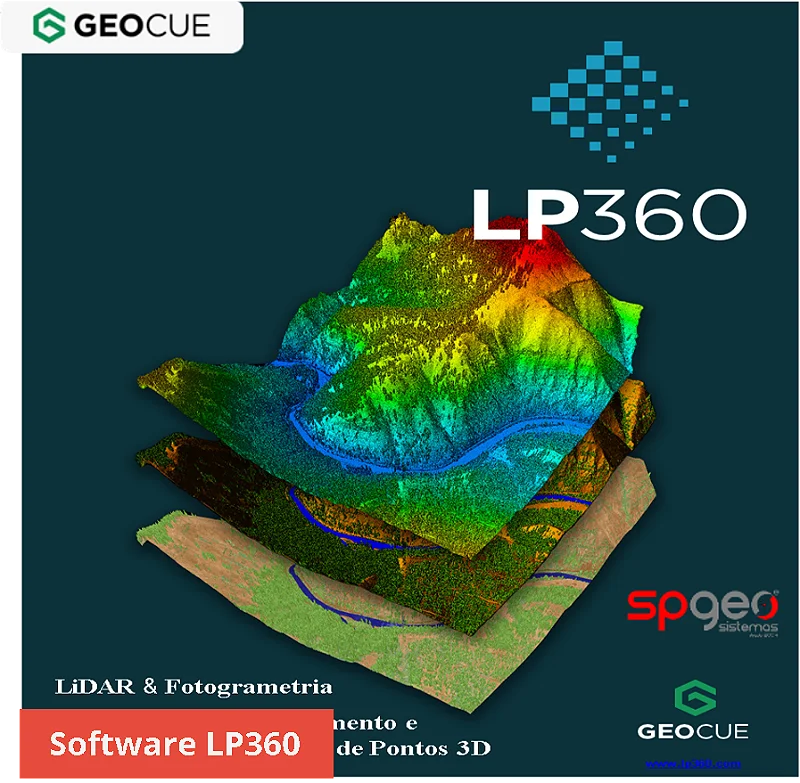
LP360
![]()
LP360 is a powerful LiDAR data processing tool designed to integrate seamlessly with GIS platforms like ArcGIS and QGIS. It specializes in visualizing, analyzing, and extracting actionable information from point cloud data. LP360 supports various LiDAR data formats and offers tools for tasks such as creating digital elevation models (DEMs), contour generation, ground classification, and volumetric analysis. Its flexibility makes it suitable for applications in forestry, urban planning, and infrastructure development. LP360 is available in desktop and drone-specific versions, providing tailored solutions for different workflows. Its user-friendly interface and robust feature set make it popular among geospatial professionals.
Advantages of LP360:
Seamless GIS Integration: Integrates directly with platforms like ArcGIS and QGIS, enabling smooth workflows within familiar environments.
Comprehensive Tools: Offers robust features for ground classification, contour generation, volumetric analysis, and more.
Versatile Application: Suitable for a wide range of use cases, from forestry to urban planning and drone-based data processing.
User-Friendly Interface: Its GUI simplifies complex LiDAR processing tasks for users with varying expertise levels.
Customizable Editions: Provides specialized versions for desktop and drone workflows, catering to diverse user needs.
Disadvantages of LP360:
Cost: It can be expensive, especially for small organizations or individual users.
Platform Dependency: Heavily reliant on GIS software like ArcGIS, which may require additional licensing.
Learning Curve: While user-friendly, some advanced features may require significant training or experience.
Limited Standalone Functionality: Not as effective when used outside GIS platforms compared to standalone LiDAR tools.
Resource Intensive: May require high-performance hardware for processing large datasets efficiently.
CloudCompare
CloudCompare is an open-source software specializing in 3D point cloud and mesh processing. It is widely used in fields such as geospatial analysis, engineering, and archaeology for tasks like data visualization, registration, segmentation, and measurement. CloudCompare supports a wide range of file formats and is compatible with large datasets, making it a go-to solution for handling LiDAR and photogrammetry outputs.
![]()
Its feature set includes tools for aligning datasets, calculating volume differences, and extracting features. With its robust performance and extensive plugins, CloudCompare is a favorite among researchers and professionals needing a free, adaptable, and powerful point cloud tool.
Advantages of FME:
Open Source: Free to use and actively supported by a global community.
Wide Format Support: Compatible with numerous point cloud and 3D mesh file formats.
Scalable for Large Datasets: Handles extensive datasets effectively, making it suitable for high-resolution LiDAR processing.
Comprehensive Feature Set: Includes tools for point cloud registration, segmentation, comparison, and volume calculation.
Customizability: Extensive plugins and scripting capabilities allow tailored workflows.
Cross-Platform: Works on multiple operating systems, including Windows, macOS, and Linux.
Active Community: Frequent updates and accessible documentation enhance usability.
Disadvantages of CloudCompare:
Limited Automation: Lacks advanced automation capabilities compared to some commercial tools.
Learning Curve: Some features and workflows may require prior experience or exploration.
No GIS Integration: Does not natively integrate with GIS software like ArcGIS or QGIS.
Resource Intensive: Handling very large datasets can be demanding on hardware.
Focused Toolset: Primarily designed for 3D point cloud and mesh processing, limiting its broader geospatial analysis capabilities.
FME
![]()
FME (Feature Manipulation Engine) is a powerful data integration platform developed by Safe Software. It is primarily used for spatial data transformation, automation, and interoperability between different GIS (Geographic Information System) formats. FME allows users to extract, transform, and load (ETL) data between hundreds of formats, including CAD, GIS, databases, and cloud services.
Advantages of FME:
Supports multiple data formats: FME can handle a vast range of spatial and non-spatial data formats.
No coding required: Users can create complex workflows using a visual interface without needing programming skills.
Automation and scheduling: FME Server enables data processing automation, reducing manual work.
Strong GIS integration: Works seamlessly with ArcGIS, QGIS, and other GIS platforms.
Disadvantages of FME:
Steep learning curve: While no coding is required, understanding FME’s transformers and logic takes time.
Expensive for small businesses: Licensing costs can be high, making it less accessible for smaller teams.
Resource-intensive: Processing large datasets can be demanding on system resources, requiring powerful hardware.
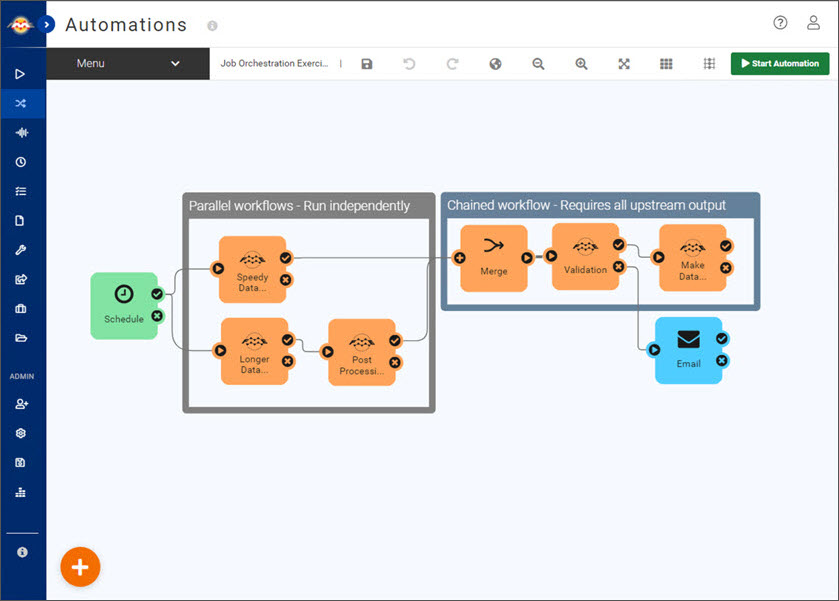
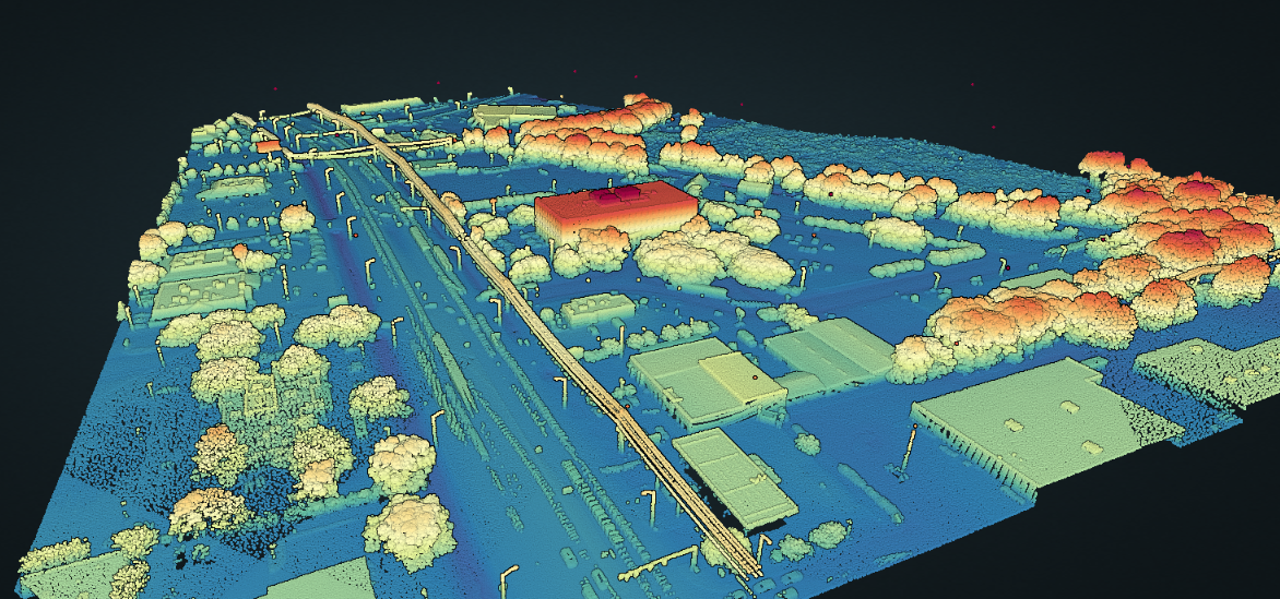
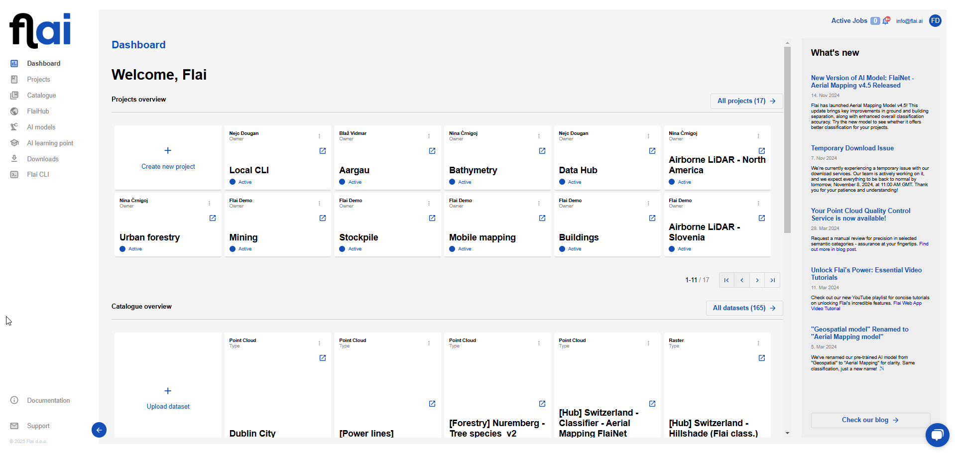
Flai

Flai is an AI-driven platform specializing in the automatic classification of LiDAR point cloud data. It offers a web-based application that processes raw LiDAR datasets into meaningful insights using advanced AI models. Flai provides pre-trained models tailored for various applications, including general mapping, forestry, and mobile mapping, with the flexibility to retrain models to meet specific user requirements. The platform supports multiple deployment options, such as Software as a Service (SaaS) and self-hosted solutions, catering to diverse operational needs. Flai's user-friendly interface and scalable infrastructure make it a valuable tool for professionals in industries like environmental management, urban planning, and infrastructure monitoring.
Advantages of Flai:
AI-Powered Classification: Utilizes advanced AI models for accurate and efficient point cloud classification, reducing manual effort.
Pre-Trained and Custom Models: Offers pre-trained models for various applications and allows retraining to meet specific user needs.
Flexible Deployment: Provides both SaaS and self-hosted options, accommodating different operational requirements.
User-Friendly Interface: Features an intuitive web-based application that simplifies the processing of LiDAR data.
Scalability: Capable of handling large datasets efficiently, making it suitable for extensive projects.

Disadvantages of Flai:
Dependence on AI Models: The accuracy of classifications relies on the quality and training of AI models, which may require updates for new data types.
Learning Curve: Users unfamiliar with AI-based tools may require time to adapt to the platform's functionalities.
Cost Considerations: While offering advanced features, the platform may involve costs that could be a factor for budget-conscious users.
Try Flai
Selecting the right LiDAR processing software depends on your specific requirements, such as budget, expertise, and the scope of your projects. Each of the tools we’ve covered brings unique strengths to the table—LAStools for its efficiency, LP360 for its GIS integration, CloudCompare for open-source flexibility, and FME for data transformation. However, Flai stands out with its AI-driven approach, which simplifies and automates point cloud classification, reducing manual effort and saving time. Its pre-trained and customizable models, combined with flexible deployment options and scalability, make it a forward-thinking solution. For professionals looking to leverage cutting-edge technology for accurate and efficient LiDAR processing, Flai offers an unparalleled advantage.
Recent Posts
How to Keep Original (Ground) Labels Unchanged When Using Flai Classification
Pushing the Boundaries of Situational Awareness at REPMUS 2025: Our AI-Driven REA Journey